|
GPS Equipment
Magellan Meridian Platinum GPS with 32MB SD RAM Data Card
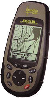
Magellan Meridian Gold GPS with 32MB SD RAM Data Card
SporTrak Pro
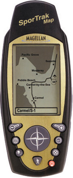
SporTrak Map
Magellan Meridian Platinum GPS with 32MB SD RAM Data Card
 |
| Position Update Rate | : 1 per second continuous |
| Display Size | : 2.3"(W) x 1.4" (H) |
| Back Lit Display and Keypad | : Yes |
| Display Resolution | : 120 x 160 Pixels |
| Receiver | :12 Parallel Channel, WAAS Enabled |
v Position Accuracy
| Horizontal Accuracy | : <3 meters, 95% 2D RMS w/ WAAS |
| Vertical Accuracy | : 10 meters RMS |
| Velocity | : 0.1 knots RMS |
| Way Points | : Store up to 500 waypoints |
| Routes | : 20 reversible routes |
| Track points | : 2000 track points |
| Map datum | : 76 Datums including 1 user- defined |
| Grids | : Lat/ Lon, UTM, OSGB, MGRS, Finnish,German, Swedish,
Swiss,USNG, User Guide |
| Operating Temperature | : 14°F to 140°F/ -10°C to 60°C |
v Meridian Platinum include
- Meridian Platinum Receiver
- Meridian PLatinum Manual
- 16 MB total built-in map
- PC Cable
- *3 Axis electronic Compass and Barometer
- 32 SD Memory Card
- 2 AA Batteries
- Canvas carrying case
v Handheld GPS
- Quadrifilar Antenna
- Dedicated zoom in zoom out key
- NMEA 0183 Data Interface
- Up to 14 hrs continuous battery life
v Maps & Navigation
- 16MB of built-in Street maps and memory
includes Highways, Major Roads, Cities, Lakes, Rivers,
3 Axis
Electronic Compass, Barometer and more
- 7 customizable navigation screens and vertical track
profile and more
- Upload Points of Interest and topographic map data
from MapSend CDs
- Download way points and routes to PC
v New Rugged Design
- Large high-contrast screen
- Waterproof-Trak it anywhere (IEC-529 IPX7-Float)
v Special Features
- Save Track to Route
- Satellite Status Display
- Built-in Help
- Northfinder with Sun/Moon
- Positions
- Sunrise/Sunset Calculator
- Best Fish and Game Calculator
- Horizontal Profile
- Address Search
v Bonus Offer
- Topographic Base Map Data for Asia Pacific Region is
included
|
Goto Top
Magellan Meridian Gold GPS with 32MB SD RAM Data Card
 |
| Position Update Rate |
: 1 per second continuous |
| Display Size |
: 2.3"(W) x 1.4" (H) |
| Back Lit Display and Keypad |
: Yes |
| Display Resolution |
: 120 x 160 Pixels |
| Receiver |
: 12 Parallel Channel, WAAS Enabled
Track and uses up to 12 satellites |
v Position Accuracy
| Horizontal Accuracy |
: <3 meters, 95% 2D RMS w/ WAAS |
| Vertical Accuracy |
: 10 meters RMS |
| Velocity |
: 0.1 knots RMS |
| Way Points |
: 500 each with name, symbol and
map display options |
| Routes |
: 20 reversible routes |
| Track points |
: 2000 track points |
| Map datum |
: 76 Datums including 1 user- defined |
| Grids |
: Lat/ Lon, UTM, OSGB, MGRS, Finnish, German,Swedish,
French, Irish, Swiss, USNG, User Grid |
| Operating Temperature |
: -10°C to 60°C (14°F to 140°F) |
v Meridian Gold include
- Meridian Gold Receiver
- Meridian gold Manual
- 16 MB total built-in map
- PC Cable
- 32 SD Memory Card
- 2 AA Batteries
- Canvas carrying case
v Handheld GPS
- Quadrifilar Antenna
- Dedicated zoom in zoom out key
- NMEA 0183 Data Interface
- Up to 14 hrs continuous battery life
v Maps & Navigation
- 16MB of built-in Street maps and memory includes Highways, Major Roads, Cities, Lakes, Rivers
Compass, Barometer and more
- 7 customizable navigation screens and vertical track
profile and more
- Upload Points of Interest and topographic maps data
from MapSend CDs
- Download way points and routes to PC
v New Rugged Design
- Large high-contrast screen
- Waterproof-Trak it anywhere (IEC- 529 IPX7-Float)
v Special Features
- Save Track to Route
- Satellite Status Display
- Built-in Help
- Northfinder with Sun/Moon
- Positions
- Sunrise/Sunset Calculator
- Best Fish and Game Calculator
- Horizontal Profile
- Address Search
v Bonus Offer
- Topographic Base Map Data for Asia Pacific Region
is included
|
Goto Top
SporTrak Pro
 |
| Position Update Rate |
: 1 per second continuous |
| Display Size |
: 2.3"(W) x 1.4" (H) |
| Back Lit Display and Keypad |
: Yes |
| Display Resolution |
: 104 x 160 Pixels |
| Receiver |
: 12 Parallel Channel, WAAS Enabled
Track and uses up to 12 satellites |
v Position Accuracy
| Horizontal Accuracy |
: <3 meters, 95% 2D RMS w/ WAAS |
| Vertical Accuracy |
: 10 meters RMS |
| Velocity |
: 0.1 knots RMS |
| Way Points |
: 500 each with name, symbol and
map display options |
| Routes |
: 20 reversible routes |
| Track points |
: 2000 track points |
| Map datum |
: 76 Datums including 1 user- defined |
| Grids |
: Lat/ Lon, UTM, OSGB, MGRS, Finnish, German,Swedish,
French, Irish, Swiss, USNG, User Grid |
| Operating Temperature |
: -10°C to 60°C (14°F to 140°F) |
v SporTrak Pro include
- SporTrak Pro GPS Receiver
- SporTrak User Manual
- PC Cable
- 2 AA Batteries
- Canvas carrying case
v Handheld GPS
v Maps & Navigation
- 32MB of built-in maps and memory
9 MB North American basemap of roads, parks,
waterway, airports, etc.,
23 MB additional built-in memory for uploadable
topographic map data
- 9 customizable navigation screens
- Upload Points of Interest and topographic maps data from
MapSend CDs
- Download way points and routes to PC
v New Rugged Design
- Large high-contrast screen
- Waterproof-Trak it anywhere (IEC-529 IPX7-Float)
v Special Features
- Save Track to Route
- Satellite Status Display
- Built-in Help
- Northfinder with Sun/Moon
- Positions
- Sunrise/Sunset Calculator
- Best Fish and Game Calculator
- Horizontal Profile
- Address Search
v Bonus Offer
- Topographic Base Map Data for Asia Pacific Region
is included
|
Goto Top
SporTrak Map
 |
| Position Update Rate |
: 1 per second continuous |
| Display Size |
: 2.3"(W) x 1.4" (H) |
| Back Lit Display and Keypad |
: Yes |
| Display Resolution |
: 104 x 160 Pixels |
| Receiver |
: 12 Parallel Channel, WAAS Enabled
Track and uses up to 12 satellites |
v Position Accuracy
| Horizontal Accuracy |
: <3 meters, 95% 2D RMS w/ WAAS |
| Vertical Accuracy |
: 10 meters RMS |
| Velocity |
: 0.1 knots RMS |
| Way Points |
: 500 each with name, symbol and
map display options |
| Routes |
: 20 reversible routes |
| Track points |
: 2000 track points |
| Map datum |
: 76 Datums including 1 user- defined |
| Grids |
: Lat/ Lon, UTM, OSGB, MGRS, Finnish, German,Swedish,
French, Irish, Swiss, USNG, User Grid |
| Operating Temperature |
: -10°C to 60°C (14°F to 140°F) |
v SporTrak Map include
- SporTrak Map GPS Receiver
- SporTrak User Manual
- PC Cable
- 2 AA Batteries
- Canvas carrying case
v Handheld GPS
v Maps & Navigation
- 8MB of built-in maps and memory
2 MB North American basemap of roads, parks,
waterway, airports, etc.,
6 MB additional built-in memory for uploadable
topographic map data
- 9 customizable navigation screens
- Upload Points of Interest and topographic maps data from
MapSend CDs
- Download way points and routes to PC Computer
v New Rugged Design
- Large high-contrast screen
- Waterproof-Trak it anywhere (IEC-529 IPX7-Float)
v Special Features
- Save Track to Route
- Satellite Status Display
- Built-in Help
- Northfinder with Sun/Moon
- Positions
- Sunrise/Sunset Calculator
- Best Fish and Game Calculator
- Horizontal Profile
- Address Search
v Bonus Offer
- Topographic Base Map Data for Asia Pacific Region
is included
|
Goto Top
|