|
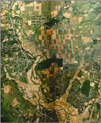
Aerial Photography
Suntac Technologies provides high-end aerial photography technologies
 |
- Aircraft designed for the purpose with experienced Air Survey crew
- Modern aerial camera systems
- New high resolution films
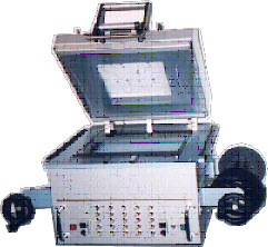
- Automated high quality film processing
facilities
- Well equipped photographic laboratories
- Precision airborne GPS positioning
systems
- Aerial georeferencing systems
- Roll-feed film scanning
- Modern Computerized photo-mapping facilities
|
|
v Services Offered:
 |
- Aerial film processing
- High quality photographic products
- Diapositive production
- Precise GPS satellite and inertial positioning
- Precise scanning and photo-mapping
|
   |
|